Water and energy are interconnected. A frequent term to describe
this relationship is the “water-energy nexus.”
Energy for Water: Energy is needed to store water, get it where
it is needed and also treat it to be used:
* Extracting water from rivers and streams or pumping it
from aquifers, and then conveying it over hills and into storage
facilities is a highly energy intensive process. The State Water
Project (SWP) pumps water 700 miles, including up nearly 2,000
feet over the Tehachapi Mountains. The SWP is the largest single
user of energy in California. It consumes an average of 5 billion
kWh per year. That’s about 2 to 3 percent of all electricity
consumed in California
* Water treatment facilities use energy to pump and process
water for use in homes, businesses and industry
* Consumers use energy to treat water with softeners or
filters, to circulate and pressurize water and to heat and cool
water
* Wastewater plants use energy to pump wastewater to
treatment plants, and also to aerate and filter it at the plant.
Different end uses require more electricity for delivery than
others. Water for residential, commercial and industrial end-use
needs the most energy (11 percent), followed by agricultural
end-use (3 percent), residential, commercial and industrial
supply and treatment (3 percent), agricultural water supply and
treatment (1 percent) and wastewater treatment (1 percent),
according to the California Energy Commission.
Water for Energy: Water is used to generate electricity
* Water is needed either to process raw materials used in a
facility or maintaining a plant,or to just generate electricity
itself.
Overall, the electricity industry is second only to agriculture
as the largest user of water in the United States. Electricity
production from fossil fuels and nuclear energy requires 190,000
million gallons of water per day, accounting for 39 percent of
all freshwater withdrawals in the nation. Coal, the most abundant
fossil fuel, currently accounts for 52 percent of U.S.
electricity generation, and each kWh generated from coal requires
withdrawal of 25 gallons of water.
Primeval Energy Ltd is entering into a strategic partnership
with Global Water Farms (GWF) through which Primeval staff
members will provide geothermal assistance to GWF in their
Southern California desalination project. GWF has an ambitious
yet realistic business plan to provide vast volumes of clean
water to augment the flow of water in the Colorado River
through desalination, Primeval said in a press release. GWF
will use the salt by-product for the manufacture of salt-based
construction blocks, creating a second environmentally focused
business that lowers the demand for traditional cinder blocks.
The Salton Sea facility will require considerable energy in the
form of Combined Heat and Power, the companies said.
For all the damage that microplastics are doing to the planet,
it may be that only an impending threat to the human body will
direct the kind of attention to the issue that it has long
deserved. That moment, researchers say, is here. Several recent
studies into microplastics, the voluminous and tiny (think 5mm
or smaller) bits of material that can take hundreds of years to
degrade, suggest not only that they are everywhere, but that
they’re making their way into our bloodstreams–with potentially
hazardous results. The research isn’t nearly complete, and
the science is evolving. … The threat of microplastics to
some of our body functions is real, and it is growing. …
Plastic-based products and their detritus are everywhere on
Earth. Microplastics are in the food we eat, even
raw fruits and vegetables, and have been found
in both tap and bottled water.
On the surface, Victoria by the Bay is a charming neighborhood
of 926 homes only a short walk from the shores of San Pablo
Bay. But the ground beneath the roughly 200-acre
development was once home to the former Pacific Refinery Co., a
facility built in 1966 that produced 55,000 barrels of oil
daily and stored other hazardous substances in the northernmost
corner of Hercules, adjacent to Rodeo.
Water use in California is typically thought of in three parts:
water for the environment (50%), water for agriculture (40%),
and water for communities (10%) per the Public Policy Institute
of California (PPIC). As a result, “ag” is the sector of the
economy that comes to mind first when we talk about the state’s
water supply. But the rest of California’s economy also
requires water. California’s manufacturers – one of the state’s
largest industry sectors, accounting for 11.8% of state GDP –
need water. -Written by Lance Hastings, President and CEO of
the California Manufacturers & Technology
Association.
Pacific Gas and Electric Co. is shutting down its
15.5-mile-long Main Tuolumne Canal, the chain of flumes and
ditches that conveys 95% of Tuolumne Utilities District’s
drinking water supply, this Sunday, April 28, to next Sunday,
May 5, and TUD is urging all of its customers to limit water
use for the temporary shutdown. … The Main Tuolumne
Canal outage is strictly for routine biannual maintenance on
the flumes and ditches each spring and fall. Beginnings of the
Main Tuolumne Canal, which brings water from Lyons Reservoir to
Phoenix Powerhouse, and other ditches further downstream that
are owned by TUD, date back to the 1850s when Gold Rush miners
needed water at their diggings in places like Sonora and
Columbia.
The Federal Energy Regulatory Commission last week rejected a
massive pumped hydropower proposal on the Navajo Nation in
Arizona, cementing a new agency policy to no longer advance
energy projects opposed by tribes whose land would be affected.
The Navajo Nation filed comments last month opposing the
proposed Big Canyon Pumped Hydro project, which would have
dammed the Lower Colorado River and flooded hundreds of acres
to create reservoirs to store and dispatch power. The tribe
warned that the storage project could create “adverse impacts”
to water and cultural resources, as well as the tribe’s water
rights. Those comments were enough to nix the project’s
preliminary permit application, which had been pending since
2020.
Something spectacular is happening in the Golden State.
California—the fifth-largest economy in the world—has
experienced a record-breaking string of days in which the
combined generation of wind, geothermal, hydroelectric and
solar electricity has exceeded demand on the main electricity
grid for anywhere from 15 minutes to 9.25 hours per day. These
clean, renewable electricity sources are collectively known as
wind-water-solar (WWS) sources. … With the future growth
of both utility-scale and rooftop solar, however, California
will ultimately provide 100 percent WWS during summer daytime
hours as well. Solar, though, provides electricity during the
day only.
Emerald Bay is known for its beauty, with an island castle at
its center, and an underwater state park full of sunken boats.
But that’s not all that lies beneath the water’s surface. Two
defunct, lead-clad telecommunications cables run across the
mouth of the bay and along Tahoe’s southwestern shores. An
ongoing court battle and investigation by the Wall Street
Journal have brought the cables into the public eye. The
California Sportfishing Protection Alliance has sued AT&T
to have the cables removed, while competing studies by AT&T
and WSJ resulted in drastically different findings on whether
the lines pose any risk to the lake and its visitors.
State lawmakers are considering a bill that would let two
energy companies with coal-fired power plants in northwest
Colorado hang on to their water rights even after the plants’
planned closures in 2028. Senate Bill 197 says that industrial
water rights held by Xcel Energy and Tri-State Generation and
Transmission Association Inc. will be protected from
abandonment through 2050. Under Colorado law, a water right
that is not being used could end up on an abandonment list,
which is compiled every 10 years. Abandonment is the official
term for one of Colorado’s best-known water adages: Use it or
lose it. It means that the right to use the water is
essentially canceled and ceases to exist. The water goes back
into the stream where another water user can claim it.
… California has some of the tightest toxic regulations and
strictest air pollution rules for smelters in the country. But
some residents of the suburban neighborhoods around Ecobat
don’t trust the system to protect them. … Uncertainty,
both about the safety of Ecobat’s operation going forward and
the legacy of lead it has left behind, weighs heavily on them.
… Early on, environmental officials flagged reasons for
concern about the lead smelter. State and federal regulators
issued an order and a consent decree in 1987 because of the
facility’s releases of hazardous waste into soil and water. An
assessment from that time found “high potential for air
releases of particulates concerning lead.”
Plumas County recently commissioned an independent review of
vested mining rights for the Engels-Superior Mines, situated in
the county. Best Best & Krieger LLP (BBK), a prominent law
firm, undertook this investigation, posting its findings in a
detailed memorandum on April 15, 2024. The memorandum addresses
a request by California-Engels Mining Company (owner) and US
Copper Corp (applicant). This request pertains to the Engels
Mine and Superior Mine located in Indian Valley on the Feather
River watershed. The memorandum, accessible on the Plumas
County Zoning Administrator website, illuminates the historical
context and legal intricacies surrounding the mining
operations. It discusses five determinations sought by the
applicant, including the mining history, vesting date, extent
of mining, continuity of mining rights, and intent to continue
mining.
Last year, U.S. hydropower electricity generation fell to
its lowest since 2001. This year, we expect hydropower to
increase 6% and account for 250 billion kilowatthours of
electricity generation in the power sector, based on forecasts
in our Short-Term Energy Outlook (STEO). We expect
hydropower to increase in nearly every part of the country,
with notable increases in the Southeast and in the Northwest
and Rockies. We expect other regions with significant
hydropower generation to either increase slightly, such as in
New York, or remain about the same, such as in California.
The U.S. has a long record of extracting resources on Native
lands and ignoring tribal opposition, but a decision by federal
energy regulators to deny permits for seven proposed hydropower
projects suggests that tide may be turning. As the U.S. shifts
from fossil fuels to clean energy, developers are looking for
sites to generate electricity from renewable sources. But in an
unexpected move, the Federal Energy Regulatory Commission
denied permits on Feb. 15, 2024, for seven proposed hydropower
projects in Arizona and New Mexico. The reason: These projects
were located within the Navajo Nation and were proposed without
first consulting with the tribe. FERC said it was “establishing
a new policy that the Commission will not issue preliminary
permits for projects proposing to use Tribal lands if the Tribe
on whose lands the project is to be located opposes the
permit.” -Written by Emily Benton Hite, Assistant
Professor of Sociology and Anthropology, Saint Louis
University; and Denielle Perry Associate, Professor
at the School of Earth and Sustainability, Northern
Arizona University.
The sunlight glints off a geometric shape across the glassy
surface of a reservoir in the Golan Heights. This is a solar
array, with panels mounted on floating pontoons, and anchored
to the banks, rising and falling with the water level. The
innovation of “dual use” reservoirs — providing water storage
on the one hand, and “green” energy on the other — is just the
latest advance pioneered by the Jewish National Fund (JNF),
which manages Israel’s forests and farmland. …
California has not seen a major reservoir built since the late
1970s, but Israel built hundreds of small reservoirs from 1990
to 2010, after a water crisis in the 1970s and 1980s prompted
the government to expand the system’s capacity.
The U.S. Environmental Protection Agency (EPA) today announced
a proposed settlement with Shasta-Siskiyou Transport of
Redding, Calif. to resolve claims of Clean Water Act (CWA)
violations after one of the company’s trucks overturned and a
fuel product spilled into storm drains in downtown Redding. The
fuel reached the Sacramento River. The proposed settlement
requires Shasta-Siskiyou Transport to pay a civil penalty of
$208,840. … On Jan. 21, 2022, one of Shasta-Siskiyou
Transport’s trucks was transporting transmix, a mixture of
gasoline, diesel fuel, and other petroleum distillates, when
the truck overturned in downtown Redding, releasing transmix
into nearby storm drains, which led directly to Calaboose Creek
and subsequently into the Sacramento River.
Over the past few decades, the United States has imported most
of its lithium from Chile and Argentina, but there’s one major
domestic source of the mineral—Nevada. Clayton Valley, a remote
basin in the nation’s driest state, is home to the Silver Peak
mine, where lithium is extracted in gridded ponds that turn
neon blue as they recover one of Earth’s lightest elements
through solar evaporation. … Mining operators across the
West have faced major barriers in the global race for lithium.
Mines come with large footprints that can disrupt wildlife
habitat, harm cultural sites and put pressures on communities.
On top of all that is another major challenge posing a barrier
for lithium projects in the western U.S. and Clayton Valley:
Competition for limited water supplies.
Hydropower generated for electricity from Oregon and Washington
dams fell to historically low levels last year, and experts
expect it could drop further by year’s end. Officials at the
U.S. Energy Information Administration recently published data
showing that hydropower generation in the Northwest between
Oct. 1, 2022 and Sept. 30, 2023 dropped to a 22-year
low. … Across the West, hydropower generation in
2022 and 2023 was down 11% from 2021, according to the data.
California was an outlier, doubling the amount of hydropower
generated due to record rainfall and snowpack.
Two letters filed with the Federal Energy Regulatory Commission
(FERC) reveal details of the damage at PG&E’s Lake
Spaulding Powerhouse No. 1, which is out of service since early
March. The failure of the powerhouse, combined with a massive
rockslide over the PG&E-owned starting portion of the South
Yuba Canal, have effectively cut off water supplies from the
higher elevations to the Bear River and Deer Creek. The State
Historic Preservation Officer’s letter to FERC provides
additional information on the damage discovered by PG&E.
… I asked my boss about his restaurant choice. He said he’d
gone vegan after learning how much Colorado River water
irrigates cattle feed — almost a third of all river
consumption, according to a recent study. His comment made
me reconsider my own beef consumption. … And most
Angelenos would find eating one less burger a week much easier
than tearing out their lawns (which I also advocate!). -Written by Aaron Mead, a writer based in the Los Angeles
area.
Canals in California may soon feature a new look — solar panel
canopies, designed to stop evaporation and soak up the sun’s
rays, created under a new project funded with help from the
federal government to boost green energy
infrastructure. Governor Gavin Newsom joined staff from
the U.S. Bureau of Reclamation on Thursday to highlight a new
“solar-over-canal” project along one of the state’s primary
aqueducts. The pilot project proposes placing a solar canopy to
“float” over a major waterway as a source of renewable energy
that can also prevent loss of precious water through
evaporation. Adam Nickels, Deputy Regional Director at the
Bureau of Reclamation, said that the Biden Inflation Reduction
Act helped make it possible to pick a portion of the
Delta-Mendota Canal for placement of a solar panel in Merced
County.
On Jan. 26, there was an opening ceremony at the Salton Sea for
the construction of a big new plant to produce lithium.
Presiding at the ceremony was John Podesta, who is the senior
adviser to President Biden in implementing the $375 billion
Clean Energy and climate change bill that was part of the
Inflation Reduction Act passed in August 2022. It was Podesta
who worked with the U.S. Army Corps of Engineers to speed up
the environmental review for the lithium plant. But at the same
time, the Army Corps has recently announced that it is
postponing a restoration plan for the Salton Sea until 2030 or
2032. Many are saying that the method of extracting lithium at
the Salton Sea is less damaging to the environment than
traditional open pit mining and evaporation ponds. -Written by Chuck Parker, a Coachella Valley
resident who has been active in the Salton Sea Coalition
since 2018.
As mining operations ramp up across Arizona, two massive
projects facing opposition from environmental groups and Native
American tribes have public comment deadlines in the coming
weeks. The Arizona Department of Environmental Quality is
accepting comments on the proposed Resolution Copper project
near Superior through April 7 and for the Copper World project
in the Santa Rita Mountains, about 30 miles south of Tucson,
through April 10. … Oak Flat sits over one of the
largest remaining copper deposits in the world. The mine would
sink more than 7,000 feet into the ground, where temperatures
reach 180 degrees Fahrenheit. It would require large quantities
of water for cooling, dust control to remediation of mine
waste.
[Denise] Moreno Ramírez wasn’t surprised when she heard an
Australian mining company, South32, planned to open a
manganese, zinc, lead and silver operation in the same area
where her family had worked. … But this latest proposed mine
was alarming, she said, because Biden is fast-tracking
it in the name of the energy transition – potentially
compromising the mountain’s delicate ecosystems, many of which
have begun to be restored as mines have shut
down. … A growing network of Arizona residents say
that allowing the mine to proceed as planned could introduce a
grave new layer of environmental injustices.
…Conservationists say they worry that South32 is seeking to
use water irresponsibly amid long-term drought.
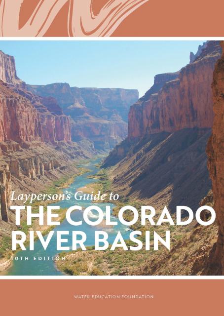
Learn the history and challenges facing the West’s most dramatic
and developed river.
The Layperson’s Guide to the Colorado River Basin introduces the
1,450-mile river that sustains 40 million people and millions of
acres of farmland spanning seven states and parts of northern
Mexico.
The 28-page primer explains how the river’s water is shared and
managed as the Southwest transitions to a hotter and drier
climate.
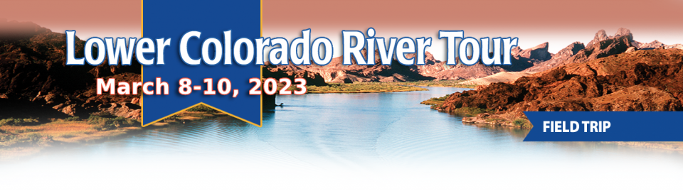
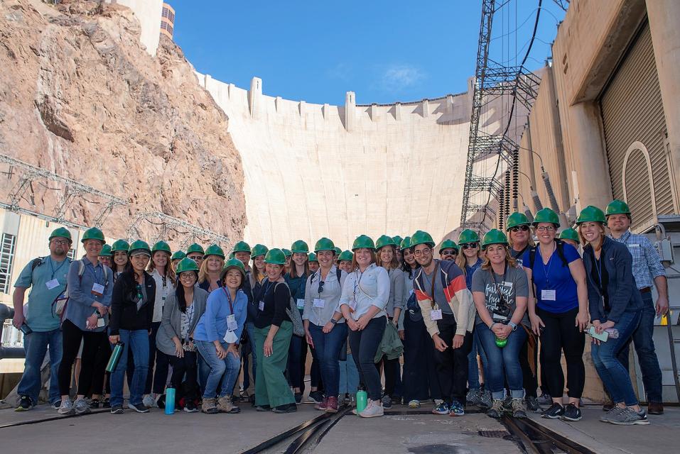
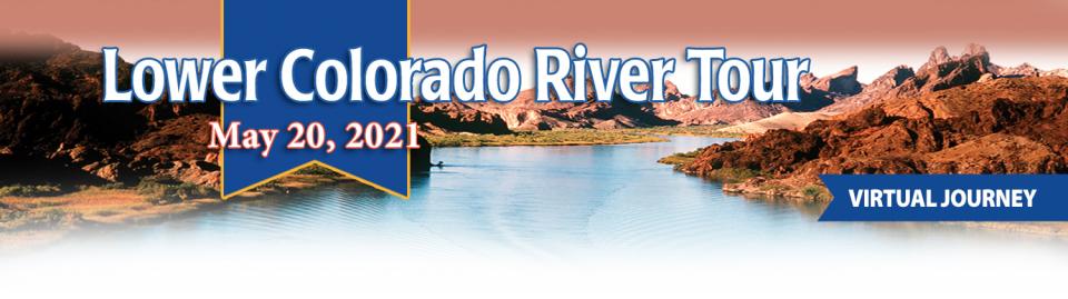
This tour explored the lower Colorado River firsthand where virtually every drop of the river is allocated, yet demand is growing from myriad sources — increasing population, declining habitat, drought and climate change.
The 1,450-mile river is a lifeline to some 40 million people in the Southwest across seven states, 30 tribal nations and Mexico. How the Lower Basin states – Arizona, California and Nevada – use and manage this water to meet agricultural, urban, environmental and industrial needs was the focus of this tour.
Hilton Garden Inn Las Vegas Strip South
7830 S Las Vegas Blvd
Las Vegas, NV 89123
This special Foundation water tour journeyed along the Eastern Sierra from the Truckee River to Mono Lake, through the Owens Valley and into the Mojave Desert to explore a major source of water for Southern California, this year’s snowpack and challenges for towns, farms and the environment.
This tour explored the lower Colorado River firsthand where virtually every drop of the river is allocated, yet demand is growing from myriad sources — increasing population, declining habitat, drought and climate change.
The 1,450-mile river is a lifeline to some 40 million people in the Southwest across seven states, 30 tribal nations and Mexico. How the Lower Basin states – Arizona, California and Nevada – use and manage this water to meet agricultural, urban, environmental and industrial needs was the focus of this tour.
Hyatt Place Las Vegas At Silverton Village
8380 Dean Martin Drive
Las Vegas, NV 89139
The lower Colorado River has virtually every drop allocated, yet demand is growing from myriad sources — increasing population, declining habitat, drought and climate change.
The 1,450-mile river is a lifeline to 40 million people in the Southwest across seven states, 30 tribal nations and Mexico. How the Lower Basin states – Arizona, California and Nevada – use and manage this water to meet agricultural, urban, environmental and industrial needs was the focus of this tour.
Hyatt Place Las Vegas At Silverton Village
8380 Dean Martin Drive
Las Vegas, NV 89139
This event explored the lower Colorado River where virtually every drop of the river is allocated, yet demand is growing from myriad sources — increasing population, declining habitat, drought and climate change.
The 1,450-mile river is a lifeline to 40 million people in the Southwest across seven states and Mexico. How the Lower Basin states – Arizona, California and Nevada – use and manage this water to meet agricultural, urban, environmental and industrial needs was the focus of this tour.
The majestic beauty of the Sierra
Nevada forest is awe-inspiring, but beneath the dazzling blue
sky, there is a problem: A century of fire suppression and
logging practices have left trees too close together. Millions of
trees have died, stricken by drought and beetle infestation.
Combined with a forest floor cluttered with dry brush and debris,
it’s a wildfire waiting to happen.
Fires devastate the Sierra watersheds upon which millions of
Californians depend — scorching the ground, unleashing a
battering ram of debris and turning hillsides into gelatinous,
stream-choking mudflows.
This tour explored the lower Colorado River where virtually every drop of the river is allocated, yet demand is growing from myriad sources — increasing population, declining habitat, drought and climate change.
The 1,450-mile river is a lifeline to 40 million people in the Southwest across seven states and Mexico. How the Lower Basin states – Arizona, California and Nevada – use and manage this water to meet agricultural, urban, environmental and industrial needs is the focus of this tour.
Silverton Hotel
3333 Blue Diamond Road
Las Vegas, NV 89139
We explored the lower Colorado River where virtually every drop
of the river is allocated, yet demand is growing from myriad
sources — increasing population, declining habitat, drought and
climate change.
The 1,450-mile river is a lifeline to 40 million people in
the Southwest across seven states and Mexico. How the Lower Basin
states – Arizona, California and Nevada – use and manage this
water to meet agricultural, urban, environmental and industrial
needs was the focus of this tour.
Hampton Inn Tropicana
4975 Dean Martin Drive, Las Vegas, NV 89118
This three-day, two-night tour explored the lower Colorado River
where virtually every drop of the river is allocated, yet demand
is growing from myriad sources — increasing population,
declining habitat, drought and climate change.
The 1,450-mile river is a lifeline to 40 million people in
the Southwest across seven states and Mexico. How the Lower Basin
states – Arizona, California and Nevada – use and manage this
water to meet agricultural, urban, environmental and industrial
needs is the focus of this tour.
Best Western McCarran Inn
4970 Paradise Road
Las Vegas, NV 89119
This 30-minute documentary-style DVD on the history and current
state of the San Joaquin River Restoration Program includes an
overview of the geography and history of the river, historical
and current water delivery and uses, the genesis and timeline of
the 1988 lawsuit, how the settlement was reached and what was
agreed to.
This 25-minute documentary-style DVD, developed in partnership
with the California Department of Water Resources, provides an
excellent overview of climate change and how it is already
affecting California. The DVD also explains what scientists
anticipate in the future related to sea level rise and
precipitation/runoff changes and explores the efforts that are
underway to plan and adapt to climate.
20-minute DVD that explains the problem with polluted stormwater,
and steps that can be taken to help prevent such pollution and
turn what is often viewed as a “nuisance” into a water resource
through various activities.
Many Californians don’t realize that when they turn on the
faucet, the water that flows out could come from a source close
to home or one hundreds of miles away. Most people take their
water for granted; not thinking about the elaborate systems and
testing that go into delivering clean, plentiful water to
households throughout the state. Where drinking water comes from,
how it’s treated, and what people can do to protect its quality
are highlighted in this 2007 PBS documentary narrated by actress
Wendie Malick.
A 30-minute version of the 2007 PBS documentary Drinking Water:
Quenching the Public Thirst. This DVD is ideal for showing at
community forums and speaking engagements to help the public
understand the complex issues surrounding the elaborate systems
and testing that go into delivering clean, plentiful water to
households throughout the state.
Water truly has shaped California into the great state it is
today. And if it is water that made California great, it’s the
fight over – and with – water that also makes it so critically
important. In efforts to remap California’s circulatory system,
there have been some critical events that had a profound impact
on California’s water history. These turning points not only
forced a re-evaluation of water, but continue to impact the lives
of every Californian. This 2005 PBS documentary offers a
historical and current look at the major water issues that shaped
the state we know today. Includes a 12-page viewer’s guide with
background information, historic timeline and a teacher’s lesson.
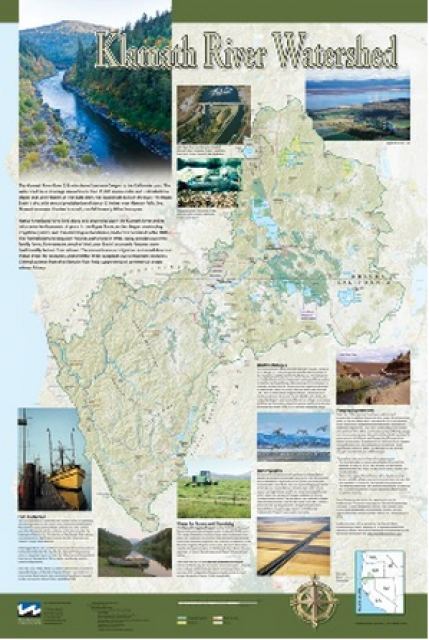
This beautiful 24×36 inch poster, suitable for framing, displays
the rivers, lakes and reservoirs, irrigated farmland, urban areas
and Indian reservations within the Klamath River Watershed. The
map text explains the many issues facing this vast,
15,000-square-mile watershed, including fish restoration;
agricultural water use; and wetlands. Also included are
descriptions of the separate, but linked, Klamath Basin
Restoration Agreement and the Klamath Hydroelectric Agreement,
and the next steps associated with those agreements. Development
of the map was funded by a grant from the U.S. Fish and Wildlife
Service.
A companion to the Truckee River Basin Map poster, this 24×36
inch poster, suitable for framing, explores the Carson River, and
its link to the Truckee River. The map includes Lahontan Dam and
Reservoir, the Carson Sink, and the farming areas in the basin.
Map text discusses the region’s hydrology and geography, the
Newlands Project, land and water use within the basin and
wetlands. Development of the map was funded by a grant from the
U.S. Bureau of Reclamation Mid-Pacific Region, Lahontan Basin
Area Office.
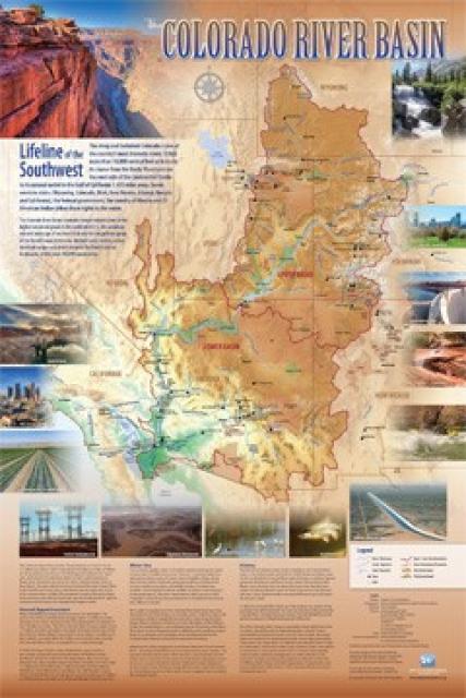
Redesigned in 2017, this beautiful map depicts the seven
Western states that share the Colorado River with Mexico. The
Colorado River supplies water to nearly 40 million people in
Arizona, California, Colorado, Nevada, New Mexico, Utah, Wyoming
and Mexico. Text on this beautiful, 24×36-inch map, which is
suitable for framing, explains the river’s apportionment, history
and the need to adapt its management for urban growth and
expected climate change impacts.
The Water Education Foundation’s second edition of
the Layperson’s Guide to The Klamath River Basin is
hot off the press and available for purchase.
Updated and redesigned, the easy-to-read overview covers the
history of the region’s tribal, agricultural and environmental
relationships with one of the West’s largest rivers — and a
vast watershed that hosts one of the nation’s oldest and
largest reclamation projects.
The 24-page Layperson’s Guide to California Water provides an
excellent overview of the history of water development and use in
California. It includes sections on flood management; the state,
federal and Colorado River delivery systems; Delta issues; water
rights; environmental issues; water quality; and options for
stretching the water supply such as water marketing and
conjunctive use. New in this 10th edition of the guide is a
section on the human need for water.
The construction of Glen Canyon Dam
in 1964 created Lake Powell. Both are located in north-central
Arizona near the Utah border. Lake Powell acts as a holding tank
for outflow from the Colorado River Upper Basin States: Colorado,
New Mexico, Utah and Wyoming.
The water stored in Lake Powell is used for recreation, power
generation and delivering water to the Lower Basin states of
California, Arizona, and Nevada.
Every five years the California Department of Water Resources
updates its strategic plan for managing the state’s water
resources, as required by state law.
The California Water Plan, or Bulletin 160, projects the
status and trends of the state’s water supplies and demands
under a range of future scenarios.
This printed issue of Western Water looks at hydraulic
fracturing, or “fracking,” in California. Much of the information
in the article was presented at a conference hosted by the
Groundwater Resources Association of California.
The connection between water and energy is more relevant than
ever. After existing in separate realms for years, the maxim that
it takes water to produce energy and energy to produce water has
prompted a re-thinking of management strategies, including an
emphasis on renewable energy use by water agencies.
This printed issue of Western Water looks at the energy
requirements associated with water use and the means by which
state and local agencies are working to increase their knowledge
and improve the management of both resources.
This printed issue of Western Water examines
desalination – an issue that is marked by great optimism and
controversy – and the expected role it might play as an
alternative water supply strategy.
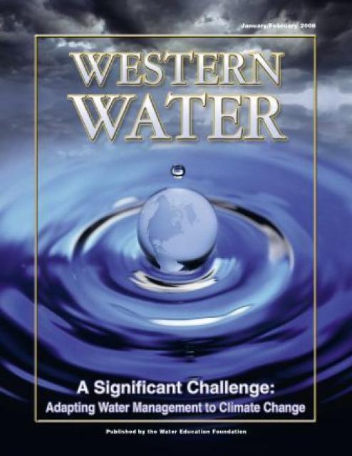
This printed copy of Western Water examines climate change –
what’s known about it, the remaining uncertainty and what steps
water agencies are talking to prepare for its impact. Much of the
information comes from the October 2007 California Climate Change
and Water Adaptation Summit sponsored by the Water Education
Foundation and DWR and the November 2007 California Water Policy
Conference sponsored by Public Officials for Water and
Environmental Reform.
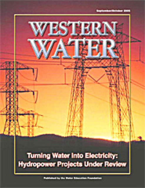
Hydropower generation is prevalent in the West, where rapidly
flowing river systems have been tapped for generations to produce
electricity. Hydropower is a clean, steady and reliable energy
source, but the damming of rivers has exacted a toll on the
environment, affecting, among other things, the migration of fish
to vestigial spawning grounds. Many of those projects are due to
be relicensed by the Federal Energy Regulatory Commission.
The California power crisis has made international headlines. But
what is the link between water and power in California? How is
the state’s dry spell affecting its hydropower generation? How
has the electric crisis affected water users in the state? These
questions and others are addressed in this issue of Western
Water.


")